All Pioneers (100)
Profile 20 of 100
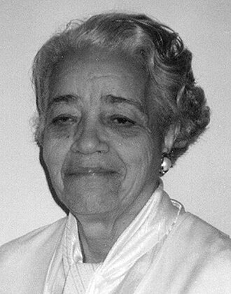
Gladys West
Lifespan 1930–
Technical Depth advanced
Key Breakthrough High-Precision Gravitational Geoid Model for GPS & Geosat Processing
Focus Areas
satellite geodesy gravitational modeling orbital mechanics GPS architecture
Topic Keywords
#GPS #satellite-geodesy #gravitational-geoid #orbital-mechanics #IBM-7030 #WGS-84 #NSWC
Source: Historical Biographical Archive / Wikimedia Commons

Gladys West

Mathematician, Satellite Geodesist & Pioneer of the Global Positioning System (GPS)

Biographical Overview

Programmed the mathematical satellite geodesy models and gravitational Earth shape calculations that made the Global Positioning System (GPS) possible. West computed complex orbital perturbations on the IBM 7030 Stretch supercomputer at the Naval Surface Warfare Center, creating the World Geodetic System baseline.

"When you're working every day, you're not thinking, "What impact is this going to have on the world?" You're thinking, "I've got to get this right.""

— Gladys West

Key Technical Breakthroughs & Inventions

01
Gravitational Geoid Mathematical Modeling At the Naval Surface Warfare Center Dahlgren Laboratory, derived the high-precision geoid—the equipotential gravitational surface model of the Earth—accounting for lunar/solar tidal distortions and terrestrial mass variations required for orbital satellite trilateration in GPS.
02
Supercomputing Orbital Perturbations (IBM 7030 Stretch) Programmed the IBM 7030 Stretch supercomputer to calculate astronomical perturbations and ephemerides, proving that gravitational resonance between Neptune and Pluto dictated long-term orbital stability.
03
Radar Altimetry Processing for Seasat & Geosat-1 Led satellite altimetry data analysis on Seasat (1978) and authored the technical specification "Data Processing System Specifications for the Geosat-1 Satellite Radar Altimeter" (NSWC TR 86-218), achieving centimeter-level sea-surface topography mapping.
04
Foundation for Global Coordinate Systems (WGS 84) Her computational algorithms established the baseline geodetic parameters integrated into the World Geodetic System (WGS 84), the standard coordinate reference frame used by all modern satellite navigation and geospatial software.
💡

Historical Context & Impact

In short

Despite calculating the complex gravitational equations that allow GPS satellites to pinpoint locations across Earth to within centimeters, Gladys West preferred keeping a paper road atlas in her car and navigating by her own instincts.

Selected Honors & Industry Recognition

Original Publications, Papers & Archives

Connected Contemporaries

All 100 Pioneers →